Buried and Forgotten: How Modern GIS Is Exposing America's Underground Infrastructure Emergency
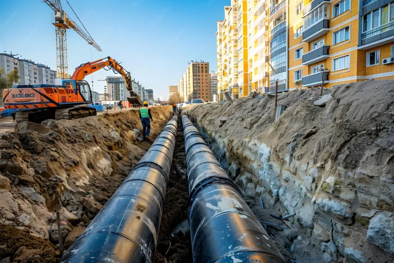
Photo: city underground utility infrastructure pipe maintenance excavation urban, via img.freepik.com
What You Can't See Can Hurt You
Beneath the streets of virtually every American city lies a network of pipes, conduits, and cables that most residents never think about—until something goes catastrophically wrong. A water main ruptures on a Monday morning, flooding a downtown corridor. A gas line, installed during the Eisenhower administration, fails silently before a spark ignites it. A sewer system, overwhelmed by a storm event, backs up into homes across an entire neighborhood.
These are not hypothetical scenarios. They are recurring headlines. And in many cases, they share a common root cause: municipal infrastructure managers are making critical maintenance decisions based on incomplete, outdated, or entirely absent geospatial data.
According to the American Society of Civil Engineers, the United States receives a D+ grade for its drinking water infrastructure, with an estimated 240,000 water main breaks occurring annually. The financial toll exceeds $2.6 billion per year in direct damage and lost water alone. Yet the deeper crisis is not simply one of aging materials—it is one of mapping intelligence. Many cities still rely on hand-drawn utility diagrams, paper records digitized decades ago, or siloed departmental databases that cannot communicate with one another.
The consequences of this information gap are measured in dollars, disruptions, and sometimes lives.
The Data Deficit Driving Infrastructure Failures
When a utility crew in a mid-sized American city needs to excavate near a gas line, they typically consult a system that may not reflect the last twenty years of infrastructure changes. Lateral connections added during a subdivision development in 2003, a rerouted main from a road-widening project in 2011, a temporary bypass that somehow became permanent—these updates often exist only in the memory of a retired public works employee or in a filing cabinet no one has opened since the Obama administration.
This is not a problem unique to small municipalities. Legacy data fragmentation affects major metropolitan areas as well. The difference is that larger cities increasingly have the budget and institutional will to address it through modern GIS platforms, while smaller communities remain exposed.
Geospatial information systems offer a fundamentally different approach. Rather than treating utility records as static documents, modern GIS platforms treat infrastructure as a living, queryable spatial dataset. Every pipe segment, valve, junction, and service connection exists as a georeferenced object with associated attributes—material type, installation date, maintenance history, pressure rating, and proximity to other assets. When conditions change, the data changes with them.
From Paper Maps to Predictive Maintenance
The city of Toledo, Ohio, offers an instructive example of what a deliberate investment in utility GIS can accomplish. Facing an aging water distribution system with segments dating to the 1890s, the city undertook a comprehensive asset mapping initiative that integrated historical records, field verification data, and sensor outputs into a unified geospatial platform. The result was not merely a better map—it was a risk model.
By layering pipe age, material composition, soil corrosivity data, and historical break frequency across the spatial network, Toledo's utility managers could identify which segments were statistically most likely to fail within a five-year window. Preventive replacement of those segments reduced emergency repair callouts significantly and allowed the city to sequence capital investments more efficiently than a simple age-based replacement schedule would have permitted.
Similar initiatives have taken root in cities ranging from Louisville, Kentucky, to Tucson, Arizona, where water scarcity makes every lost gallon a policy emergency. In each case, the transition from reactive to intelligence-driven maintenance depended on one foundational capability: knowing precisely where every asset is, what condition it is in, and how it relates spatially to the rest of the system.
Accelerating Emergency Response Through Spatial Awareness
Beyond preventive maintenance, geospatial mapping delivers measurable value in the critical minutes following an infrastructure failure. When a water main breaks, the ability to identify and isolate the affected segment quickly—shutting the correct upstream valves without disrupting service to unaffected areas—can be the difference between a contained incident and a neighborhood-wide outage lasting days.
Traditional response protocols often require field crews to physically locate valves based on institutional memory or paper records, a process that can consume thirty minutes or more during which water continues to flow and structural damage compounds. GIS-enabled field applications allow crews to pull up a georeferenced valve network on a mobile device, identify the optimal isolation sequence in seconds, and navigate directly to each asset.
For gas utilities, the stakes are even higher. The National Transportation Safety Board has documented cases in which delayed isolation of ruptured gas mains contributed directly to fire and explosion events. Spatial awareness tools that allow dispatchers to remotely identify the nearest shutoff points and guide field teams in real time represent a meaningful advancement in public safety.
The Technology Gap and the Communities It Leaves Behind
Despite the clear operational and financial case for modern utility GIS, adoption remains uneven across the United States. The gap largely tracks with municipal fiscal capacity. Cities with robust tax bases and access to federal infrastructure grants have moved aggressively toward integrated spatial asset management systems. Many rural communities and smaller cities, however, continue to operate on legacy platforms—or no platform at all.
The Infrastructure Investment and Jobs Act, signed in 2021, allocated substantial funding for water and wastewater system improvements, and a meaningful portion of that capital is eligible for technology and planning expenditures. However, smaller municipalities often lack the grant-writing capacity and technical staff to access those resources effectively. The result is a compounding disadvantage: the communities with the oldest infrastructure and the fewest resources are also the least equipped to build the spatial intelligence systems that could help them manage that infrastructure more efficiently.
State-level GIS coordination offices and regional planning agencies have a role to play here. Several states have begun developing shared utility mapping frameworks that allow smaller jurisdictions to contribute to and draw from a common spatial database, reducing the per-municipality cost of maintaining accurate, current infrastructure records.
Location Intelligence as a Public Safety Imperative
Framing utility GIS as a technical nicety misses the point. When a water main serving a hospital fails unexpectedly, or when a gas leak goes undetected beneath a residential street, the failure is not simply operational—it is a failure of situational awareness that could have been prevented with better spatial data.
Municipalities that have made the transition to modern geospatial infrastructure management consistently report not only cost savings but improved public trust. Residents and elected officials alike respond positively to systems that demonstrate proactive stewardship of public assets. The ability to show, on a map, which segments have been assessed, which are scheduled for replacement, and which are being monitored in real time transforms abstract infrastructure policy into tangible accountability.
The underground networks that sustain American cities are, in a very real sense, the foundation of everything built above them. Mapping them accurately—and maintaining that map as a living record of spatial truth—is not an optional upgrade. It is the baseline requirement for responsible urban management in the twenty-first century.